NAVTOR - Experts & Thought Leaders








Latest NAVTOR news & announcements

NAVTOR has announced a breakthrough product launch with Risk Intelligence, helping global users of its NavStation route planning platform navigate maritime’s “dynamic risk reality” with informed peace of mind. The agreement will see Risk Intelligence’s real-time maritime security risk data integrated into NavStation, appearing as clear, customisable and relevant notifications layered onto ENCs. This will allow navigators, and relevant shore-side teams, to plan and understand voyages with safety and simplicity. Detailed port information NavStation is a key product onboard many of NAVTOR’s 18,000+ customer vessels NavStation is a key product onboard many of NAVTOR’s 18,000+ customer vessels, seamlessly layering a wealth of data – from weather updates, to detailed port information, environmental regulations, NAVAREA warnings, and much more – over ENCs for greater efficiency, compliance, and operational understanding. The software’s automated passage planning module is a key industry offering. However, as Timo Essers, e-Navigation Director at NAVTOR, explains, integrating risk analysis was, until now, “a missing piece of the puzzle.” “The dynamic nature of risk has never been more apparent,” Essers explains. “From conflict and ongoing geopolitical unrest, to piracy, narcotics, and people smuggling - in addition to increasing navigational jamming and spoofing - today’s shipping companies face a complex and ever-evolving threat landscape.” Dynamic risk reality “Navigators are, in many ways, on the front line here, and as such are under immense pressure. How can they be expected to know exactly what is happening, where it is happening, assess a multitude of parameters, and ensure safe voyages?” Essers believes NAVTOR has found the answer: “Risk Intelligence is the global leader in monitoring, validating, analysing, and assessing threats with a dedicated team of experts worldwide. They chew through huge amounts of sources to deliver digestible insights that inform safe decision-making.” “Integrating that intelligence into the maritime’s best planning platform provides huge value for our customers. This is a landmark development for our own product, but also for the industry – enabling safer, simpler and smarter navigation of a dynamic risk reality.” Detailed risk analysis The service will be available as a subscription offering on NavStation, with the flexibility of tailoring access for ongoing global coverage, or by the month for specific operations. Access can be agreed for for either individual vessels or entire fleets. The data appearing on NavStation is continuously updated, with the ability to deep-dive into individual notifications for detailed risk analysis. Essers adds that the solution unlocks “a new level of situational awareness.” Delivering decisive intelligence Speaking about the product launch with NAVTOR, Hans Tino Hansen, Founder & CEO of Risk Intelligence, comments: “Properly understanding maritime risk requires dedicated sources, resources, constant vigilance, and the ability to view individual issues through the lens of wider context and specialist analysis. Bridge officers, or office-based teams, juggling multiple responsibilities simply cannot do this. To plan and execute a safe voyage you need optimal analysis and support, now more than ever.” “By integrating our services into NAVTOR’s renowned planning platform we can deliver decisive intelligence – leading to truly informed assessments and conclusions – in a simple, seamless and powerful manner. This will help shipping companies worldwide navigate risk with confidence. We are delighted with the product launch.” Continual commitment The Risk Intelligence module is a brand-new update for NavStation 6.4, released on 29 September. Other enhancements include advances in functionality, port database refinement, routing improvements, and much more.

NAVTOR is continuing its ambitious global growth with the launch of NAVTOR Middle East, the company’s 13th dedicated regional office. Following less than a month after the creation of NAVTOR Türkiye, the new Dubai centre will help local shipping companies take advantage of the latest smart shipping solutions, delivering greater efficiencies, safety, sustainability, and business and operational performance. Amitabh Sankranti, the pioneer of NAVTOR’s breakthrough Digital Logbooks, assumes the new role of Managing Director – Middle East. Strategic importance NAVTOR has taken the decision after enjoying sustained regional growth with its portfolio NAVTOR has taken the decision after enjoying sustained regional growth with its portfolio of integrated e-Navigation and Performance solutions. The business, which has products and services on over 18,000 vessels worldwide, has announced it was time to “take the next step” after years of success with local agent Blue Chip Marine (BCM). Momentum in maritime industry Speaking about the creation of NAVTOR Middle East, Sankranti comments: “We are witnessing significant momentum in the maritime industry across the Middle East, particularly in Dubai, which continues to emerge as a major global shipping hub. The region is seeing a steady influx of new shipping companies and management firms, reinforcing its strategic importance." “For NAVTOR, having a local presence in key maritime centres is essential to supporting our customers and driving innovation. With a strong and experienced team now in place in Dubai, we are well-positioned to deliver value and expect steady, sustainable growth in the region moving forward.” Long-term commitment Existing customers are being transferred from BCM to NAVTOR Middle East, with Shamanth Denrice D'Souza also joining as Regional Sales Director – Middle East. The Dubai office will now grow to both increase awareness of NAVTOR’s unique digital ecosystem and its solutions, such as NavStation and NavFleet, and provide optimal service and support to a growing customer base. Exciting step for NAVTOR The business now has over 400 expert staff, in addition to 25 international distributors NAVTOR Founder and CEO Tor Svanes notes: “We see this as an exciting step that really underscores our commitment to long-term growth and customer success in the region.” “The cluster here is world-class, and developing all the time, so it makes perfect sense to ensure they have access to the digital solutions that can give them competitive advantage as we look ahead to a more sustainable, profitable industry." “I’d also just like to take the opportunity to thank BCM, and especially Job Alva, for playing such a vital role in building NAVTOR’s footprint in the region. The team are professional, dedicated and deeply skilled, and have been instrumental in our success here so far.” Norwegian-headquartered NAVTOR, which opened its doors in 2011, is the global pioneer in e-Navigation, with a growing market share in cutting-edge performance solutions. The business now has over 400 expert staff, in addition to 25 international distributors, with customers from approximately 90 countries.
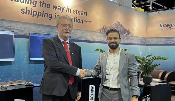
NAVTOR has taken another step in its mission to ‘make life easier’ for shipping crews and companies, announcing a fresh strategic partnership with Sweden’s Chris-Marine. The agreement will see Chris-Marine integrate its acclaimed Trust-Ocean data collection system within NAVTOR’s NavBox and NavReporting platforms, empowering greater efficiency and data accuracy for users worldwide. Simple, seamless, accurate Jacob Clausen, Director of Performance, NAVTOR, says the move will help “optimise smart shipping solutions” and “unlock next level benefits” for both vessel crews and onshore teams. “This is a tangible demonstration of our commitment to work with fellow segment leaders to deliver optimal value across the NAVTOR digital ecosystem,” Clausen comments. “Chris-Marine’s hardware and expertise make data capture simple and accurate, allowing for greater auto-population of data within reporting, reduced crew workloads, less manual errors, and better onshore insights, with high-frequency operational data consistently delivered to shore-based verifiers and stakeholders.” “It both streamlines operations and provides added value, driving better decision-making through seamless, high quality data flows.” NavReporting NavReporting is NAVTOR’s innovative, highly automated noon reporting tool It's a move that further strengthens NAVTOR’s ecosystem, which currently delivers smart shipping products and services to more than 18,000 vessels in the world fleet. Integrated, accurate and secure data can now be shared across Digital Logbooks, e-Navigation systems, Performance and Monitoring solutions, and more. NavReporting is NAVTOR’s innovative, highly automated noon reporting tool. Shared vision “With over six decades of experience, Chris-Marine has been delivering precision tools for marine engines alongside cutting-edge monitoring technology. We’re delighted to bring our long-standing expertise on board with NAVTOR”, says Leif Abildgaard, CCO at Chris-Marine. “We share the same vision of helping shipping companies enhance efficiency, improve performance and make safe, sustainable decisions through smarter data use, so it’s a perfect match.” The agreement was announced at Nor-Shipping 2025, taking place in Lillestrøm, Norway.
Insights & Opinions from thought leaders at NAVTOR

The International Maritime Organization (IMO) is working toward a smooth transition to the next generation of navigation technologies. The standard for Electronic Navigations Charts (ENCs) is transitioning from S-57, an older, static data standard to exchange digital hydrographic data, to the new S-100, a more dynamic framework. While S-57 was limited to just ENCs, the new S-100 framework can handle a variety of data types, such as real-time tides and currents, to improve situational awareness and safety. IHO’s S-100 standard new possibilities The S-57 specification is now frozen, offering stability but limiting any further development As the current International Hydrographic Organization (IHO) standard for ENCs, S-57 enables features like alarms, real-time satellite positioning and route checks. But it is limited by a rigid structure, supporting only chart data. The S-57 specification is now frozen, offering stability but limiting any further development. In contrast, IHO’s S-100 standard offers new possibilities by supporting multiple data layers such as bathymetry (S-102), water levels (S-104) and surface currents (S-111) – which together offer mariners richer situational awareness and improved decision making. For example, dynamic under keel clearance can be visualised in real time alongside navigational data on Electronic Chart Display and Information Systems (ECDIS), supporting safer, more efficient route planning. Integration of diverse marine data The industry is currently in the testing and validation phase, ensuring the data meets user needs. Full adoption will take time as the ecosystem of systems, standards and workflows evolves. S-100 provides a flexible, interoperable framework that enables the integration of diverse marine data – from bathymetry to weather and buoyage. By using a common framework, it ensures compatibility of product specifications across systems and supports the development of richer, more dynamic digital products. ECDIS Performance Standards For over 230 years, UKHO has been giving maritime data to help ships guide safely and trade efficiently The IMO is supporting the transition to S-100 by updating (ECDIS) Performance Standards to require S-100 compatibility for all new installations (including retrofits) from January 2029. It has also designated the S-100 framework as the foundation for data exchange within its e-Navigation Maritime Services. Working to support ongoing maritime needs, the United Kingdom’s Hydrographic Office (UKHO) is a world-pioneering centre for hydrography, supporting safe, secure, and thriving oceans through trusted data and marine geospatial insight. For over 230 years, UKHO has been delivering maritime information to help ships navigate safely and trade efficiently. Adoption of marine data standards Today, UKHO sources, processes, and delivers data through the ADMIRALTY portfolio, which is relied upon by over 90% of large ships trading internationally. UKHO works with hydrographic offices, governments, defence, and industry to drive digital data access, to support the adoption of marine data standards like S-100, and to enable mariners, port operators and decision-makers to make safer, smarter choices worldwide. Innovative maritime navigation solutions UKHO is the UK's official source of marine charts and navigational data, helping ships navigate safely worldwide The UKHO and the French Hydrographic Office (SHOM) are collaborating with four ECDIS manufacturers — Furuno, NAVTOR, OSI and 7Cs — to test S-100 data in live sea trials. “In doing so, we can test the practical use and display of this data in S-100-enabled ECDIS, as well as demonstrating the practical benefits in real-world scenarios,” says Thomas Mellor, UKHO's Head of Technical Partnerships. The UKHO is the UK's official source of marine charts and navigational data, helping ships navigate safely worldwide. The UKHO delivers these quality, innovative maritime navigation solutions via its ADMIRALTY portfolio – made available to customers worldwide through a network of distributors. Navigational solutions for crews and teams NAVTOR is an ADMIRALTY Digital Distributor and an ECDIS manufacturer. As a distribution partner, NAVTOR relies on hydrographic data — like that produced by the UKHO — to deliver navigational solutions to crews and operations teams. Through the IHO Geospatial Information Registry, organisations like the International Organization for Marine Aids to Navigation (IALA) and the World Meteorological Organization (WMO) can define their own data models. These models can then be used to create S-100-compliant products, which integrate seamlessly into the wider ecosystem alongside official hydrographic data – enhancing situational awareness and decision-making for mariners. Regulatory and operational needs The two corps work near to align timelines, coordinate updates, and help with global implementation While the IHO develops and maintains the S-100 framework, the IMO ensures these standards meet regulatory and operational needs – particularly under the International Convention for the Safety of Life at Sea (SOLAS) convention. The two organisations work closely to align timelines, coordinate updates, and support global implementation. Their collaboration ensures that S-100 products and services enhance safety, support mariners, and foster wider digital innovation in navigation. S-421 Route Plan standard S-100 supports the exchange of non-geographic maritime data – such as voyage plans and route information – through the S-421 Route Plan standard. This enables vessels to share planned routes digitally with shore authorities and other ships, improving coordination, safety, and situational awareness. Under the S-100 ECDIS Performance Standard, all systems must be capable of importing and exporting S-421 data. This allows for more efficient reporting, reducing communication overhead, and supporting smarter decision-making at sea. Existing ECDIS systems Wider adoption is expected through 2027 and beyond, as part of the phased S-100 rollout S-421 has been published by the IHO and is available for implementation. Wider adoption is expected through 2027 and beyond, as part of the phased S-100 rollout. Existing ECDIS systems in service will remain compliant; there are no plans to remove or retire them. However, from January 2029, all new and retrofit ECDIS must be built to support the S-100 Performance Standard — an important step towards long-term standardisation. IHO international trial testbed standards During the transition to S-100, we will see dual-fuel operation, says Mellor. “By this, we mean that systems will need to handle both the old S-57 charts and the new S-101 ENCs – therefore comprehensive testing and collaboration across the industry is key,” he says. To support the transition, the UKHO is running S-100 ECDIS trials with other hydrographic offices, the Royal Navy, defence stakeholders and ferry operators, in accordance with IHO international trial testbed standards. This coordinated approach will help ensure interoperability and minimise disruption.
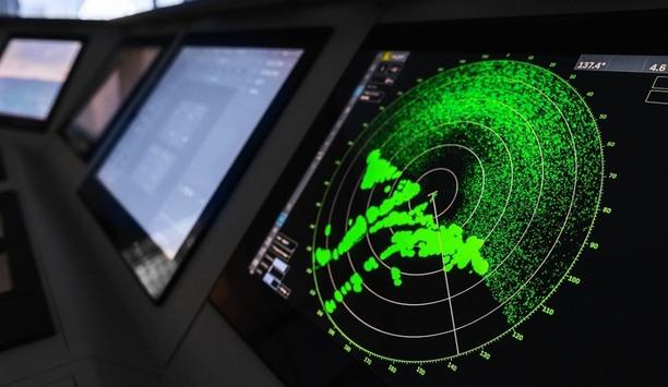
Maritime digitalisation, decarbonisation and autonomy were the dominant themes at this month's Nor-shipping conference, where mariners from around the world gathered to discuss the industry's future. But beneath these headline topics, a fundamental shift in maritime navigation is quietly underway. S-100, the next generation of maritime data standards, will transform today's static navigation systems into dynamic, real-time communication networks that revolutionise everything from autonomous navigation to sustainable voyage planning. Overcome implementation challenges All vessels will be required to have S-100 compatible ECDIS, but S-57 charts will continue We have been working closely with NAVTOR to develop S-100 compatible Electronic Chart Display and Information System (ECDIS). I spoke alongside Bjørn Kristian Sæstad and John K Klippen at the NAVTOR panel to explore how S-100 builds on the success of S-57 and what is being done in the lead up to 2029, when all vessels will be required to have S-100 compatible ECDIS but S-57 charts will continue to be supported. As the world's pioneering authority in maritime navigation, the UK Hydrographic Office (UKHO) is spearheading industry education and industry adoption of the S-100 framework. This preparation phase is critical. Success will require collaboration between maritime operators, technology providers, port authorities, and regulatory bodies to overcome implementation challenges and establish industry-wide best practices. Building on proven success The maritime industry has successfully navigated major technological transitions before, from GPS adoption to AIS system implementation. S-100 represents the next chapter in this evolution, building on S-57's proven foundation while introducing flexible and extendable capabilities to support safer, more efficient, and more sustainable maritime operations. The S-57 data platform standardised electronic chart data for over 50,000 vessels worldwide The S-57 data platform standardised electronic chart data for over 50,000 vessels worldwide. But where these charts are standalone files requiring periodic updates, S-100 takes this to the next level. As a universal hydrographic data model, S-100 enables vessels to communicate with each other, shore-based systems, and maritime infrastructure in real-time. It collates a range of data such as weather, tides and traffic into one interoperable ECDIS, providing mariners with a complete picture of their surroundings, optimising high-quality data and enhancing situational awareness. Smooth industry transition The transition from S-57 to S-100 is already underway, with many hydrographic offices preparing to produce and distribute S-100-based products by the 2026 IMO milestone. To ensure a smooth and gradual transition for maritime operators, S-100-compatible ECDIS will continue to support existing Electronic Navigational Charts (ENCs) using the current S-57 standard. This dual capability should eliminate concerns about operational disruption during the transition period. It provides time both for companies to develop S-100 compatible ECDIS and mariners to gradually incorporate S-100 enhanced capabilities and customise their displays based on the information they need. By 2029, S-100 technology will be mandatory for all vessels. Dual capability should eliminate concerns about operational disruption during the transition period To further support mariners becoming familiar with S-100 capabilities before widespread implementation, the UKHO has launched Explore S-100, an online platform where maritime professionals can experience the technology firsthand. Users can browse and interact with 'phase 1' S-100 data layers, including S-101 (ENCs), S-102 (bathymetric surface), S-104 (water levels), and S-111 (surface currents). This comprehensive educational tool is designed to make S-100 feel more like reality, allowing mariners to familiarise themselves with its new capabilities. Real-world testing Real-world testing is now moving from theory to practice. At the recent Nor-shipping conference, I spoke with NAVTOR about the first practical demonstrations of S-100 technology, including sea trials that tested the system under challenging maritime conditions. The St Lawrence River in Canada provides an ideal testing ground, featuring tidal influences, varied currents, narrow dredged navigation channels with deep-water sections, seasonal continuous survey activities, bridges, overhead cables and navigational aids. Testing standards in real-world scenarios allows us to gather feedback and make adjustments before full-scale implementation. This enables developers to fine-tune products based on actual operational experience rather than theoretical requirements. Different areas of the maritime community UKHO has partnered with SeaTrade Maritime to launch a comprehensive survey assessing industry Understanding how the technology performs in practice is only part of the picture. Gauging industry readiness for this transition is just as important. The UKHO has partnered with SeaTrade Maritime to launch a comprehensive survey assessing industry understanding of S-100. By identifying knowledge gaps, implementation concerns, and specific training needs across different areas of the maritime community, we’re informing educational programmes that address real industry requirements. Enabling tomorrow's maritime operations We are seeing major social and political change as the maritime sector works to ensure decarbonisation is at the top of the industry’s agenda. While S-100 will not be the silver bullet to facilitating decarbonisation and sustainability efforts, certain features will enable more sustainable operations. Fuel consumption and port area emissions when vessels ultimately need to wait outside congested terminals Route optimisation technology, for example, can help address one of the industry's most pressing environmental challenges: the widespread "sail fast then wait" approach. This increases fuel consumption and port area emissions when vessels ultimately need to wait outside congested terminals. S-100's real-time data sharing capabilities support just-in-time arrival strategies, enabling vessels to receive current information about port conditions, berth availability, and optimal arrival windows. This shift toward efficiency-focused voyage planning becomes increasingly critical as the industry works toward FuelEU Maritime compliance. S-100 common framework with port operators Route optimisation extends beyond individual vessels to support coordinated traffic management. When multiple ships can access the same real-time port and traffic information, the entire system operates more efficiently, reducing delays and environmental impact across the maritime supply chain. Route optimisation extends beyond individual vessels to support coordinated traffic management Sharing data using the S-100 common framework with port operators and charter parties could help to reduce demurrage penalty payments when the agreed-upon time for cargo operations (laytime) is exceeded. Sharing real-time data (ETA, berth availability, weather, cargo readiness, etc.) helps all stakeholders, charterers, shipowners, and terminal operators plan better. The impact is that it reduces idle time and delays caused by poor coordination or unexpected changes. For example, if bad weather is forecasted using S-100-compliant data, cargo operations can be rescheduled in advance, avoiding idle time that counts against laytime. Cross-industry collaboration As the maritime sector approaches the 2026 implementation milestone, the UKHO remains committed to supporting industry readiness through initiatives like Explore S-100 and comprehensive training resources. The transition offers genuine opportunities for improved operational efficiency, enhanced safety, and reduced environmental impact. These benefits require careful planning, comprehensive education, and ongoing collaboration across the maritime community. By hydrographic offices, shipping companies, technology providers, and regulatory authorities all working together, the industry can ensure S-100 delivers its full potential while maintaining the safety and reliability that mariners depend on every day.
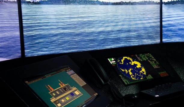
More than almost any trend, decarbonisation is driving the future of maritime. That reality alone makes decarbonisation the perfect topic for our first-ever Expert Panel Roundtable column. Traditional maritime fuels, like heavy fuel oil, release harmful pollutants that contribute to air pollution and have adverse health effects. We have to do better, and discussions in the maritime industry centre on which combination of alternative fuels and other technologies can solve the shorter- and longer-term challenges of decarbonisation. For an update on the various approaches, we asked our Expert Panel Roundtable: What are the latest maritime technology trends in decarbonisation?

Fleet planning as a strategic asset
Download